Few Drives as Scenic as Coast’s Cabrillo Highway
Where does Big Sur begin and end? Mabel settles it, then takes you the whole way — San Simeon to Point Lobos, stop by stop. Now with our interactive map and free PDF drive guide.
Few Drives as Scenic as Coast’s Cabrillo Highway
By Mabel Plaskett
There has been some controversy as to just where the Big Sur Country begins and ends. Henry Miller, noted author, living on Partington Ridge defines the boundary as all coast lands between Carmel and San Dimeon. In a recent issue of Pictorial Living, a supplement of the San Francisco Examiner, the author decided that Big Sur ended at Lucia Lodge. Since the mailing address of all residents as far south as Salmon Creek is Big Sur, I think we may call the area between Palo Colorado Canyon and Salmon Creek legitimately Big Sur Country.
Since San Simeon is an ideal starting point I will start there and take you for a drive of three or four or more hours and promise you will not be bored for a moment.
First a brief history of the Coast Road, known as Highway 1, for a few years known as Roosevelt Highway and at present the Cabrillo Highway. For many years the road ended San Corpojo on the south and Palo Colorado or Notleys Landing on the north. Between these points all traveling was done by horse back, supplies were either packed in over the mountain trail or brought in ships or launches by sea.
In 1919 work was started on the road, which before it was finished in 1937 cost dearly in both money and lives. The cost of building this road less than 90 miles in length was 10 million dollars.
A few years ago, due to the efforts of the California Historical Society the name of this part of the Coast Highway was changed to Cabrillo Highway to conform with the name used from San Diego to the Oregon line and in honor of the discoverer of Alta California, Juan Rodriguez Cabrillo, a native of Portugal who was sent north from Natividad on the Mexican mainland by Antonio de Mendoza, who had succeeded Cortez as ruler of Mexico.
Cabrillo entered San Diego bay on September 28, 1542. He spent six days here then started northward stopping at Santa Barbara and Monterey Bay, missed the great harbor of San Francisco, went as far north as Point Reyes in Mendocino County then turned back to San Miguel Island where Cabrillo died January 3, 1543. It was due to this voyage, as his chief pilot Bartolome Ferrelo continued with the expedition back to Mexico, (in accordance with Cabrillo’s instructions) that Spain could claim all of the Californias.
So we are now at the little town of San Simeon (St. Simon) on the Cabrillo Highway. To our right rises, in all its splendor, the famous Hearst Castle, now open to the public, a gift to the state from the Hearst Estate. Here may be seen some of the finest architectural marvels of Europe and one of the most exotic art collections the world has to offer. The only private property in San Simeon is Pete Sebastian’s store and gas station. Here one may buy anything from a pair of Levis to jade jewelry.
We start north, pass over the bridge at Oak Knowel Creek and soon come to Piedias Blancas (White Rocks) light house, a few miles on we cross Arroyo de la Cruz (Creek of the Cross) and proceed to San Corpojo Creek where one glimpses a wide strip of beach, where the creek dams up and seems to disappear, and nearly always a few heard of cattle are grazing along the stream.
At Salmon Creek, where we make a deep horse shoe curve we look back to see a lovely water fall. Here Los Padre National Forest maintains a guard station, where the present guard Ralph Haskins, lives with his wife, Carol, and two little girls. The road has run high above the sea since we left San Corpojo and we drive carefully on the curves. All the time we have a marvelous view of the sea and can hear the breakers below.
In quick succession we pass Villa Creek Alder Creek and Mud Creek and round a turn to see Gorda Village. Here is a lunch room, gas station and cabins. Below the road is a little church, where the residents from miles around meet on Sunday although there is no resident pastor. Sunday school is maintained and the Gorda Ladies Aid meets regularly to sew and back boxes to send wherever needed.
Farther on is Pacific Valley, where a school has been maintained since 1880. Here one sees the signs pointing the way to the famous Jade Cove and recently the forest service opened the Plaskett Creek camp and built steps down the cliff to the sand beach, which is the nicest beach along the coast. Before we leave Pacific Valley we cross Prewitt Creek, named for an early settler. Wild Cattle Creek and then Mill Creek named for saw mills operated on the stream in early days. Here is another nice little camp ground below the bridge and right on the ocean’s edge. Around the bend is Kirk Creek also named for an early settler. At this point the road from King City, via Jolon and the Nacimiento river, meets the Cabrillo Highway. The sign says King City 49 miles.
Our next bridge is Lime Kiln Creek, where lime was shipped out in the 1880’s. An interesting little beach under the bridge offers jasper and rhodonite among other minerals to the rock hound, and if one has the time the most beautiful scenic walk in the world up the creek.
We soon come to a sign “Camoldoli Hermitage” near an open gateway that leads to the Hermitage a few miles up a ridge. Here the brothers are trying to achieve a self-sustaining existence on a 600 acre place recently acquired. Across the road on the point a man named Kipp lives and is engaged in the making of pottery.
Lucia Lodge is a few miles on with a gas station and lunch room and cabins for the tourist. The lunch room extends onto an open veranda where one may eat literally over the ocean. Lucia Lodge is 50 miles from Monterey.
Vicente Creek was named for Vicente Avila whose family lived here long ago. A short way on past Gamboa Point is a drinking fountain and a memorial plaque to Senator Elmer Rigdon, one of the men responsible for the building of the road. Big Creek bridge is a beautiful structure and often a subject for the artist’s brush.
Dolan Creek was named for a man of that name and the remains of his house may be seen near the road.
A short way on. Hot Springs Lodge nestles on a shelf down close to the ocean. This well-known resort is famous for the hot mineral baths to which people come from all over the world. We cross Hot Springs Creek and then Buck Creek and Burns Creek where a family named Burns once lived.
Across Anderson Creek on the right is the home and art gallery of Emil White, whose paintings have been bought by people near and far.
We pass Free Camp or Krenkel’s Corners and approach Partington Canyon. This is a deep canyon where a dirt road leads down to a deep tunnel through the rock. At the end of the tunnel is a sheltered cover where steamers once landed. From this area tan bark was once shipping in quantity. Part of the hoisting equipment may still be seen at the landing. Where the side road leaves the highway up Partington Ridge, the names on the row of mail boxes tells the tourist that artists, authors, sculptors and other well known persons live there.
Torre Canyon is truly beautiful as we cross the bridge we can see tall redwoods and lovely shrubs and ferns in the shady depths of the canyon. Between here and Castro Canyon is Saddle Rock Ranch where you can see along the shore dark, oddly shaped rocks closely resembling a saddle.
We now come to Deetjen’s where the Big Sur Restaurant offers meals while a fine record concert is softly playing.
Soon we behold on our left the famous “Nepenthe” restaurant and we think of Poe’s lines, “Quaff, oh quaff this kind nepenthe and forget the lost Lenore.”
On the very top of Big Sur hill is Rancho Sierra Mar run by the Post family. Here again are cabins, gas and meals. The Posts are early pioneers and the old Post home nearby has recently been renovated after being vacant and in need of repair for many years. The basic structure being solid, it is now a wonderful and interesting example of early coast architecture. The Trotter brothers, able carpenters, were responsible for most of the early building in Big Sur.
On our left we soon come to a stop to admire the gorgeous begonia at Loma Vista In. They are at their loveliest now and we add several to our collection.
Sycamore Canyon road on our left leads to the famous Pfeiffer Beach, where one may collect shells of all sorts. Mrs. Alvin Dani was born and lived there until recent years, has the most amazing collection of sea shells I have ever seen.
On our right we now see the building of the Highway Maintenance Station and the U.S. Forest Headquarters. Far off we see the Ventana Mountains, so called because a drop in the Coast Range makes a window here. The Pfeiffer Big Sur State Park along the Big Sur River has camping facilities and hiking, swimming and horseback riding may be indulged. This park was donated by the Pfeiffer family who settled here in 1869. They and other old timers like the Post family were the backbone of Big Sur country. Big Sur Lodge, Redwood Lodge, Ripplewood Lodge, Walker’s Camp, River Inn, follow closely, the Big Sur Post Office is a River Inn.
Now we drive along Big Sur River. One sees people fishing any day during the season. The river is lined with shady trees and the drive is a lovely one. We pass tall redwoods and ferns.
On our left the Molera ranch buildings are nearly hidden below the road. This ranch dates back to 1834 when it was part of the 9,000 acre Rancho El Sur.
We leave the shady redwoods and come to a wide open beach and there a short distance on we see the Big Sur Lighthouse perched on top of the rocky mesa. It is 350 feet above the ocean. Build in 1899 and ever since its powerful million candle power light has been flashing its beam every 15 seconds nightly.
We round Hurricane Point and cross the little Sur river. We look eastward toward Pico Blanco (White Peak) 3,710 feet above us. The Little Sur, like San Corpojo, wells up behind a great rock and sinks in the sand. This is a lovely wide beach, but I’ve never seen anyone on it. Here also cattle graze along the river.
Now you will see Bixby Creek bridge, the highest single span concrete arch bridge in the world. An airplane has been known to fly under it. It was from this bridge the sea otter, thought to be extinct, was discovered in 1938. (Robinson Jeffers, in his poem about Big Sur, called this stream Mill Creek.)
We soon reach Palo Colorado Canyon. This canyon extends inland several miles where summer cabins are built. Here also is the Boy Scout Headquarters of which Paul Harlan is in charge.
Near the highway stands the old Swetna house, a three story log house home of Mrs. Electa Grimes. In his poem “The Women of Point Sur” Jeffers refers to this house with these lines.
“He came to the gaunt farm house that stood
High above gab-roofed barns and broken wagons;
They had told him he might be given lodging at Morheads,
High cube shaped house redwood logs squared and jointed,
Blackened with ancient weathers, chinked with white plaster,
Striped like a zebra with white plaster and the porch
Rotting under its rose-vine.”
That was many years ago. The log house will no doubt stand many more.
At the mouth of the Polo Colorado Creek is Notleys Landing where tan bark was shipped in early days. The country is less mountainous from here on and Rocky Point Lodge is on the edge of a cliff below the road.
We come to Garipata Creek (Tick Creek) where Weston Trout Farm is located on past Granite Canyon bridge where the ocean surf pounds underneath and on to Mal Paso Creek, named because of the bad crossing before the bridge was built.
We pass Yankee Point called the Carmel Riviera and cross Wildcat Creek bridge. The next point of interest is Highlands Inn overlooking Point Lobos (wolves) and China Cove. At Point Lobos State park can be seen the gnarled windblown cypress often seen on post cards. Here are facilities for picnicking.
We drive on to San Jose Creek.
Mabel's Drive up the Cabrillo Highway, 1959
Follow the drive exactly as Mabel Plaskett described it in The Land in July 1959 — San Simeon to Point Lobos, about 95 miles of Highway 1. Every stop below pairs her words with what you'll find there today. Marker positions are close approximations; the coast will make the fine navigation obvious. Allow a full day with stops, and check Caltrans (dot.ca.gov) or QuickMap before you go — Highway 1 still closes for slides, just as it has since it opened in 1937.
⬇ Save the free drive guide (PDF) print it, or keep it on your phone for the stretches with no signal — which is most of them
-
1 San Simeon & Sebastian's Store
"An ideal starting point... The only private property in San Simeon is Pete Sebastian's store and gas station. Here one may buy anything from a pair of Levis to jade jewelry."
Today: Sebastian's Store still stands (1852) near the pier, now with a café and tasting room. Hearst Castle tours run daily from the visitor center — book ahead.
-
2 Hearst Castle
"To our right rises, in all its splendor, the famous Hearst Castle, now open to the public... some of the finest architectural marvels of Europe."
Today: A California State Park since 1958 — Mabel wrote this the year after it opened to the public. The 1922 sale that ended the Plasketts' Pacific Valley years was to this same Hearst ranch.
-
3 Piedras Blancas Light Station
"We start north, pass over the bridge at Oak Knoll Creek and soon come to Piedras Blancas (White Rocks) lighthouse."
Today: Tours several mornings a week. Just south, the elephant seal rookery boardwalk is the biggest thing on this stretch that Mabel never saw — the seals only arrived in 1990. Stop; it's free.
-
4 Arroyo de la Cruz
"A few miles on we cross Arroyo de la Cruz (Creek of the Cross)."
Today: Still Hearst Ranch cattle country — the longest undeveloped stretch of the drive, much as she saw it.
-
5 San Carpoforo Creek
"One glimpses a wide strip of beach, where the creek dams up and seems to disappear, and nearly always a few herd of cattle grazing along the stream."
Today: 'San Carpojo' to the old coast families. This is where the road ended before 1937 — everything north was horse trail. The southern gateway to Big Sur by Mabel's definition.
-
6 Ragged Point
(Between her stops — the cliffs climb here.)
Today: Inn, café, gas and a black-sand-beach trail. The last easy services before Gorda; a good leg-stretch with a big view.
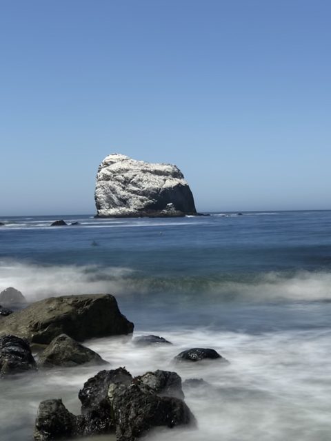
Surf and stone: the coast turns wild north of here. -
7 Salmon Creek Falls
"At Salmon Creek, where we make a deep horseshoe curve, we look back to see a lovely waterfall. Here Los Padres National Forest maintains a guard station."
Today: The 120-foot falls still shows from the horseshoe curve — park at the bend for the short trail. The guard station is gone, but the Plasketts' 'Big Sur begins here' boundary holds: this is the Monterey County line country.
-
8 Gorda
"Here is a lunch room, gas station and cabins. Below the road is a little church, where the residents from miles around meet on Sunday."
Today: Still a lunch room, cabins, and famously the most expensive gas in America — fill up before you need it. The Gorda Ladies Aid is gone; the ocean view is not.
-
9 Pacific Valley
"Farther on is Pacific Valley, where a school has been maintained since 1880."
Today: THE PLASKETT HOMELAND. William Lucas Plaskett claimed this valley in 1869; fifty children grew up here before the 1922 Hearst sale. Pacific Valley School still operates — on the east side of the highway directly at Plaskett Creek, across from Sand Dollar Beach and the campground — heir to the school the Plasketts' valley has kept since 1880. Walk the bluff trail across the road.
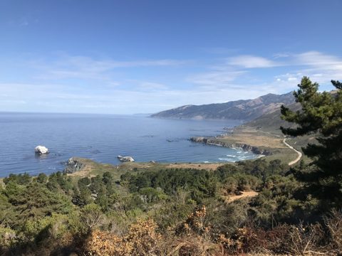
The Pacific Valley shelf from Plaskett Ridge — Sand Dollar's crescent, Plaskett Rock, and Highway 1. -
10 Sand Dollar Beach & Jade Cove
"Here one sees the signs pointing the way to the famous Jade Cove... steps down the cliff to the sand beach, which is the nicest beach along the coast."
Today: Still the biggest sandy beach on the Big Sur coast, and rockhounds still hunt nephrite jade at Jade Cove after winter storms. Taking jade from above the tide line is prohibited — what the sea hands you is yours. Family lore: Ed Plaskett and his brothers once rigged a way to the top of Plaskett Rock offshore and scraped the seagull guano for fertilizer — the crown is still white today.
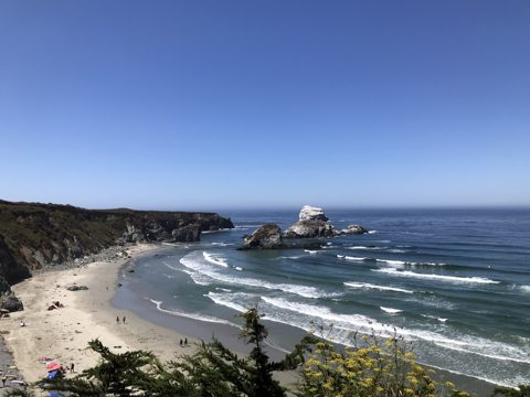
Sand Dollar Beach in full sun, Plaskett Rock standing guard. -
11 Plaskett Creek Campground
"Recently the forest service opened the Plaskett Creek camp."
Today: Camp where the family homesteaded: the campground occupies William Lucas Plaskett's 1869 homesite, and his soapstone fireplace stones are still there. Up the creek stood the family's water-wheel arrastra — see our story 'The Arrastra on Plaskett Creek.'
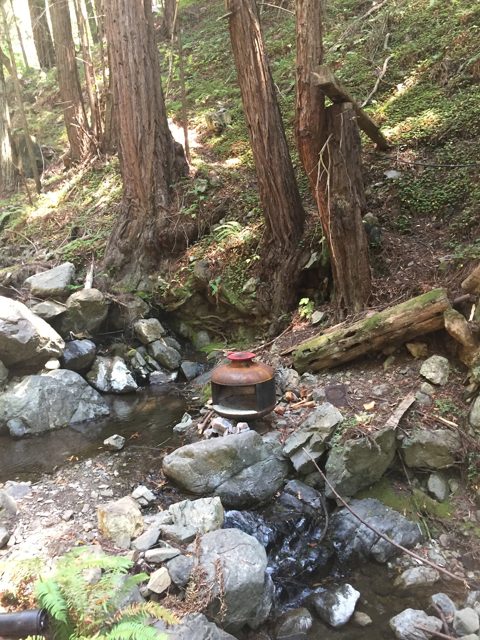
The arrastra site on Plaskett Creek — the family's water-powered gold mill. -
12 Mill Creek
"Mill Creek, named for saw mills operated on the stream in early days. Here is another nice little campground below the bridge and right on the ocean's edge."
Today: The mill was E.R. Sans's — Mabel's father's. She grew up at the mouth of this creek. The picnic ground under the bridge is still one of the coast's best-kept secrets. See 'Return to Mill Creek' in our stories.
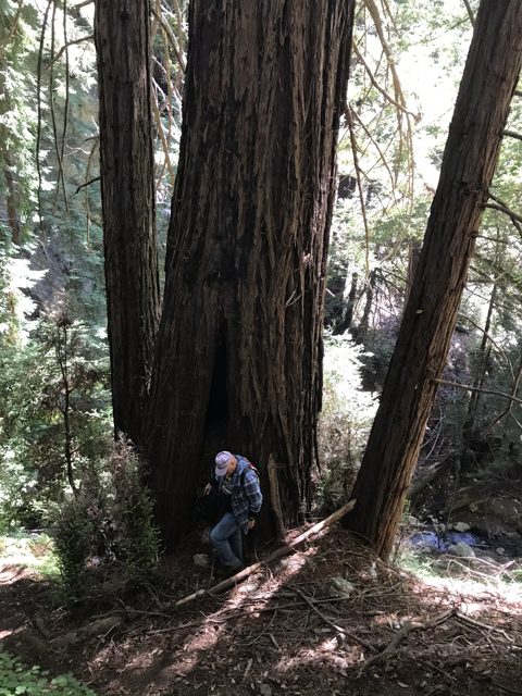
Fire-scarred old-growth redwoods above Mill Creek. -
13 Kirk Creek & Nacimiento-Fergusson Road
"At this point the road from King City, via Jolon and the Nacimiento River, meets the Cabrillo Highway. The sign says King City 49 miles."
Today: Kirk Creek Campground perches on the bluff. Nacimiento-Fergusson is still the only paved road over the Santa Lucias — the Plasketts' old mail-and-market route to Jolon and King City. It reopened to through traffic on 15 Nov 2024 after nearly four years closed (Dolan Fire + storms). Cone Peak Road / Central Coast Ridge Road remains closed to vehicles. No roadside camping for the first 12 miles east of Highway 1 (forest order through Sep 2027) — use Ponderosa or Nacimiento campgrounds on the inland side. Call Monterey Ranger District 831-385-5434 before you commit. Full inland loop: see tour 'Over the Hill — King City to Kirk Creek via Nacimiento-Fergusson'.
-
14 Limekiln Creek
"Where lime was shipped out in the 1880s... if one has the time, the most beautiful scenic walk in the world up the creek."
Today: Limekiln State Park: the four stone kilns still stand at the end of her 'most beautiful walk,' now a maintained trail through the redwoods to kilns and falls.
-
15 New Camaldoli Hermitage
"Here the brothers are trying to achieve a self-sustaining existence on a 600-acre place recently acquired."
Today: The Hermitage was two years old when she wrote; it's still there, still silent — about a dozen monks, the 2:30 a.m. bell, walled cells with private gardens. The door has opened, though: private retreats are available to anyone (two-night minimum, vegetarian meals cooked by the monks), and the bookstore sells their famous fruitcake and granola. Two miles up the drive, 3/4 mile south of Lucia.
-
16 Lucia
"Lucia Lodge is a few miles on... the lunch room extends onto an open veranda where one may eat literally over the ocean."
Today: Named for Lucia Dani of the coast's Dani family. The lodge's cliff-edge veranda survives storms and slides alike — check ahead, services here come and go with the road closures.
-
17 Rigdon Memorial & Big Creek Bridge
"A drinking fountain and a memorial plaque to Senator Elmer Rigdon, one of the men responsible for the building of the road... Big Creek bridge is a beautiful structure and often a subject for the artist's brush."
Today: The double-arched Big Creek Bridge is the painters' favorite it always was. The UC Big Creek Reserve behind the gate protects the canyon now.
-
18 Esalen (Hot Springs Lodge)
"Hot Springs Lodge nestles on a shelf down close to the ocean. This well-known resort is famous for the hot mineral baths to which people come from all over the world."
Today: Three years after her article, Hot Springs Lodge became the Esalen Institute. The baths still draw the world — by reservation (or the famous 1 a.m. public soak slots).
-
19 Julia Pfeiffer Burns State Park & McWay Falls
"Between here and Castro Canyon is Saddle Rock Ranch, where you can see along the shore dark, oddly shaped rocks closely resembling a saddle."
Today: Saddle Rock Ranch became Julia Pfeiffer Burns State Park — named for the pioneer ranchwoman in our stories. McWay Falls, dropping 80 feet onto the beach, is now the most photographed sight on the coast. Mabel doesn't even mention it: in 1959 it wasn't visible from the road.
-
20 Partington Cove
"A dirt road leads down to a deep tunnel through the rock. At the end of the tunnel is a sheltered cove where steamers once landed... the names on the row of mailboxes tell the tourist that artists, authors, sculptors live there."
Today: The 1880s tanbark tunnel is still open — the short steep trail through it to the hidden cove is one of the coast's magic moments. Henry Miller lived on the ridge above when Mabel wrote this.
-
21 Anderson Creek (Henry Miller Memorial Library)
"Across Anderson Creek on the right is the home and art gallery of Emil White, whose paintings have been bought by people near and far."
Today: Emil White's cabin on the highway is now the Henry Miller Memorial Library — bookstore, coffee, sculpture garden, and summer concerts under the redwoods. White founded it himself in memory of his friend.
-
22 Deetjen's Big Sur Inn
"We now come to Deetjen's, where the Big Sur Restaurant offers meals while a fine record concert is softly playing."
Today: Grandpa Deetjen's hand-built Norwegian inn is on the National Register now. Breakfast at Deetjen's is still the coast's favorite ritual — the candlelit rooms still have no locks worth mentioning.
-
23 Nepenthe
"Soon we behold on our left the famous Nepenthe restaurant and we think of Poe's lines, 'Quaff, oh quaff this kind nepenthe...'"
Today: Still family-run, still the terrace with the 40-mile view. The Ambrosia burger and a seat by the fire pit at sunset — do it once in your life.
-
24 Post Ranch (Rancho Sierra Mar)
"On the very top of Big Sur hill is Rancho Sierra Mar run by the Post family... The Posts are early pioneers and the old Post home nearby has recently been renovated."
Today: The Post family's hilltop is now Post Ranch Inn — the coast's most famous luxury hotel, its restaurant named Sierra Mar after the old ranch. The restored 1877 Post homestead still stands by the highway.
-
25 Pfeiffer Beach (Sycamore Canyon Road)
"Sycamore Canyon road on our left leads to the famous Pfeiffer Beach, where one may collect shells of all sorts."
Today: The unmarked right turn is deliberate — locals never signed it. Purple sand, the Keyhole Arch (photographers mob it at winter solstice sunset), and wind you'll remember. Small parking lot fills early.
-
26 Pfeiffer Big Sur State Park & Big Sur Village
"This park was donated by the Pfeiffer family who settled here in 1869. They and other old timers like the Post family were the backbone of Big Sur country. Big Sur Lodge, Redwood Lodge, Ripplewood Lodge, Walker's Camp, River Inn follow closely."
Today: The Pfeiffers settled the same year the Plasketts claimed Pacific Valley. The park's redwood loop to Pfeiffer Falls reopened after the 2020 fire. River Inn (with its chairs IN the river), Ripplewood, and the Big Sur Lodge all still serve travelers.
-
27 Andrew Molera State Park
"The Molera ranch buildings are nearly hidden below the road. This ranch dates back to 1834 when it was part of the 9,000-acre Rancho El Sur."
Today: The old ranch is Andrew Molera State Park — the mile walk to the driftwood-strewn river-mouth beach is the easiest big payoff on the coast. The 1861 Cooper Cabin is Big Sur's oldest building.
-
28 Point Sur Light Station
"The Big Sur Lighthouse perched on top of the rocky mesa... built in 1899 and ever since its powerful million-candlepower light has been flashing its beam every 15 seconds nightly."
Today: The great volcanic rock and its 1889 lighthouse are a State Historic Park — docent-led tours a few days each week are the only way up, and worth planning around. The shipwreck stories in our archive happened on these rocks.
-
29 Little Sur River & Pico Blanco view
"We look eastward toward Pico Blanco (White Peak), 3,710 feet above us. The Little Sur, like San Carpojo, wells up behind a great rock and sinks in the sand. This is a lovely wide beach, but I've never seen anyone on it."
Today: Still nobody on it — the beach is closed to protect snowy plovers, so enjoy exactly the view she did. Pico Blanco's limestone crown gleams the same white.
-
30 Hurricane Point
"We round Hurricane Point..."
Today: The windiest pullout on the highway and the classic long view back over Bixby Bridge — hold onto your hat and your car door.
-
31 Bixby Creek Bridge
"The highest single-span concrete arch bridge in the world. An airplane has been known to fly under it. It was from this bridge the sea otter, thought to be extinct, was discovered in 1938."
Today: The most photographed bridge in California (and the Big Little Lies title shot). The otters she mentions came back from those 50 survivors to the whole coast. Park only in the pullouts — it's a working highway.
-
32 Palo Colorado Canyon & Notleys Landing
"Near the highway stands the old Swetnam house, a three-story log house... At the mouth of the Palo Colorado Creek is Notleys Landing where tan bark was shipped in early days."
Today: Her marker for the NORTH end of Big Sur Country. The redwood canyon was hit hard by the 2016 Soberanes Fire; the road up it remains closed to through traffic. Jeffers' 'zebra-striped' log house appears in our Point Sur stories.
-
33 Rocky Point
"Rocky Point Lodge is on the edge of a cliff below the road."
Today: The cliff-edge restaurant still serves that view.
-
34 Garrapata State Park
"We come to Garrapata Creek (Tick Creek) where Weston Trout Farm is located, on past Granite Canyon bridge where the ocean surf pounds underneath."
Today: Now Garrapata State Park: Calla Lily Valley blooms in late winter, Soberanes Point trails year-round. Free, unsigned, and the locals' favorite stretch.
-
35 Malpaso Creek & Yankee Point
"Mal Paso Creek, named because of the bad crossing before the bridge was built. We pass Yankee Point, called the Carmel Riviera."
Today: The 'bad crossing' later named Clint Eastwood's production company. The Carmel Riviera is now exactly as expensive as it sounds.
-
36 Point Lobos State Natural Reserve
"At Point Lobos State Park can be seen the gnarled windblown cypress often seen on postcards. Here are facilities for picnicking."
Today: 'The greatest meeting of land and water in the world.' Reserve parking fills by mid-morning — the Cypress Grove and Sea Lion Point loops are short and unforgettable. Whales pass December–May.
-
37 San Jose Creek — journey's end
"We drive on to San Jose Creek."
Today: Monastery Beach, at the edge of Carmel. Mabel's 'three or four hours' still holds if you don't stop — but you will stop. Give it the day; she gave it her whole life.